Original English text
|
From Carbon Credit Tb Green Credia
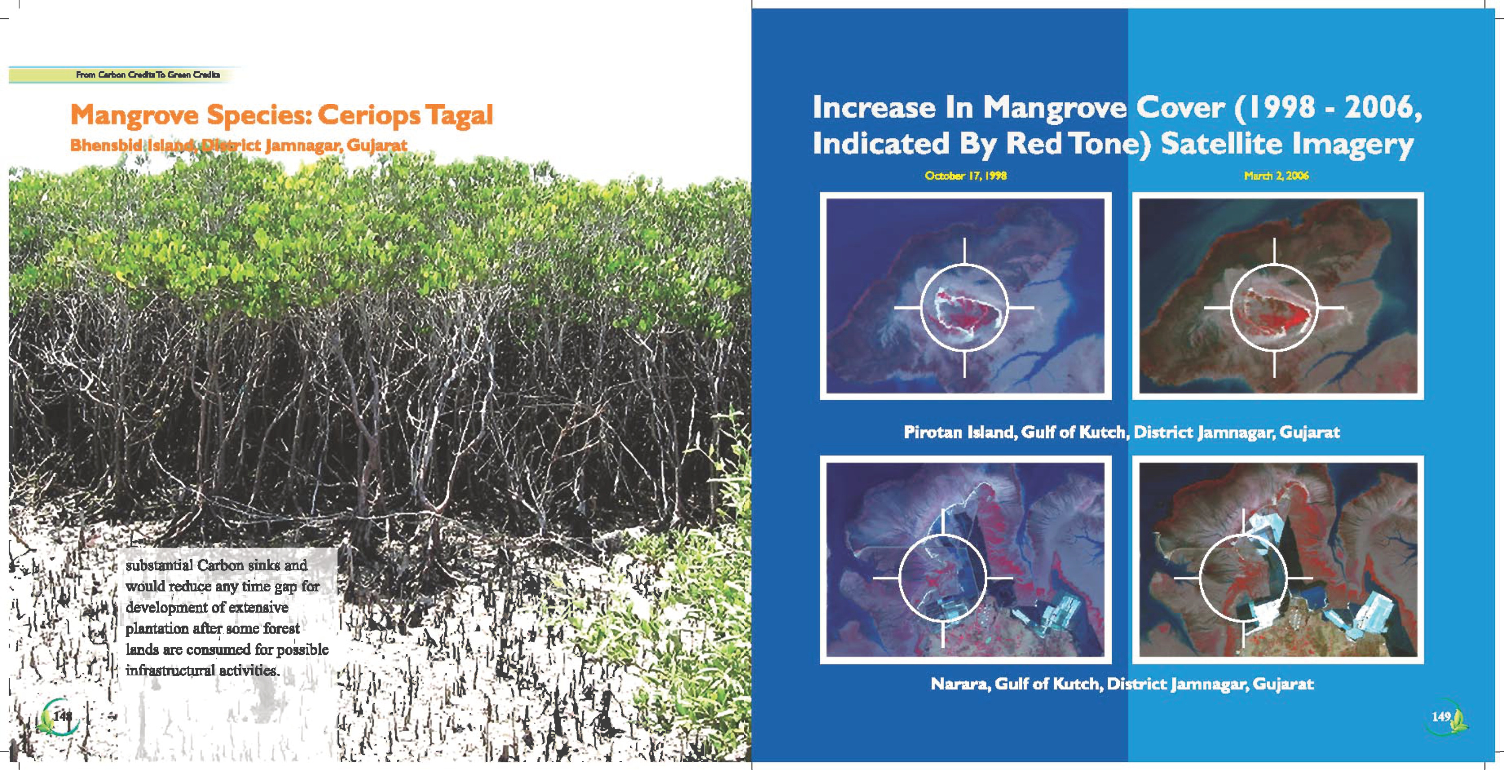
Mangrove Species: Ceriops Tagal Increase In Mangrove Cover (1998 - 2006,
Bhensbidilslandaiiyict Jamnagar, Gujarat Indicated By Red Tone) Satellite Imagery
a ot 4 Jt Many! iy " oe Br. ry Ne ci uty ate .
peat Bs Wave ATi ‘t0e dai me MEE ee PEN Si D » i duals call October 17, 1998 March 2, 2006
reset ecaan ahah i Ag Sree Ne i o is ae Hs Bi tava
Sagi ate I Mic in na ba ay.
Peet SR RMR Rat Sea EAA Lanes” High
Res ati Oe ee a era DAC y BOT FEN oY ats SRE Rots as Yet) PHA eg
PAYS Sepp anes Ace GCE a AG BATS IGEN AS MD Re GEE, PDA
RDA NO AR Sind | SNARE N SAUDE Wy Iie DEN ENCE APT DEP SEL Ged ay an ;
ti. a K AEA S \ eye. BBY Ay ; wvpee DN DN Le BN en bee © 0s Gan ap i ioe:
PRA CURIE SVE Do Ne ES OER tar ON) ICR ON 7g. os
nee BENT /5 bot ~ SSD MTEL I Be Boke * PCR i lg
. as Lin ee io yf: “Sf AN if 3 { { ; : eH Fe eS Fs K j aN ere
eth! Mea AN bd [= if EIN oN a. ‘MI { NK Pirotan Island, Gulf of Kutch, District Jamnagar, Gujarat
hier Pies OM ga” Fx SM PALA ale AN AL WY
Sag Ae Sed 4d Be Mn POOL Ok ORE rm
ae ay ne vas PA ena vine Se ce aS ete '7 4 ae et See Ph: si oe \
Ng hc a rs see 4 SP aimee rath ae RS ei
Or oe a wien RS ot SR Ne ae ‘ .
iia substantial Carbon sinks and i aoa eared = Ey, eee
. DNisl ce P would reduce any time gap for Reg.” ae ey “Ar 5 i Peso ASE aN 2 waif
Ay Me ney development of extensive Fn, So ar , Ope i io Fate E \ 97 ‘ A > Samez
) at 1 sted | plantation after some'forest. v4 % ‘t mtd pene Gre Peau sae ig as fe ee
fe 4 “fy od lands are consumed for possible - “Yt, ac) 0 eae BES Re ee a 7 a
ik HUY infrastructural activities. ery AT a | Rg ke Namastey io . :
igen esd ah ey Ht: “ih ae t é 1g AG * Narara, Gulf of Kutch, District Jamnagar, Gujarat
A ae oe Pan Me eonane WN eo ATES BU co bt ?
Red ep ete here Vhs es Se
3 <i . O74 ai! ae os AS Me: sh fos la
a ee